
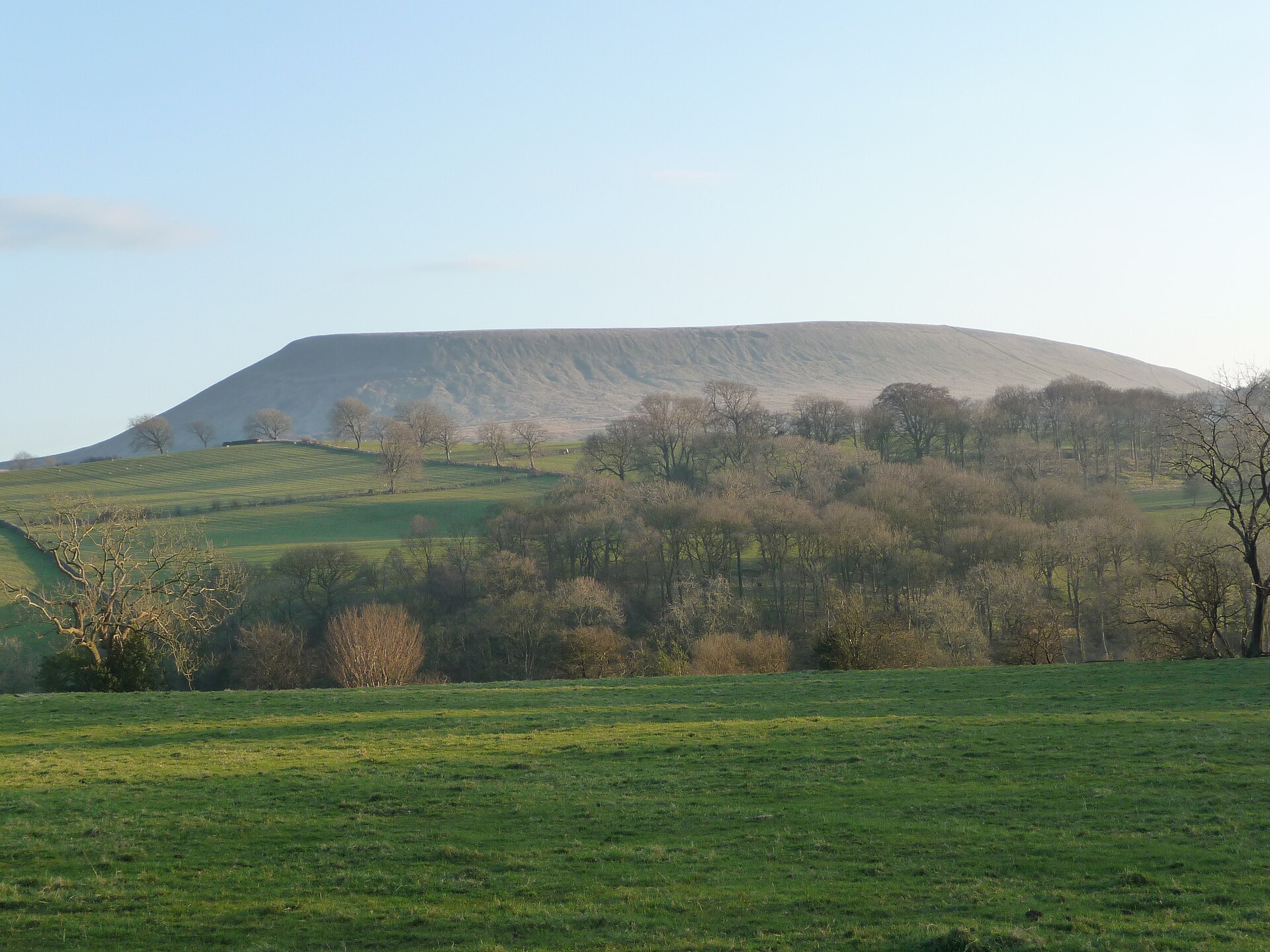
Pendle Hill is a broad, isolated summit in east Lancashire. It dominates the land around it and carries some of the best-recorded history in English hill country. This guide explains what the hill is, where it sits and how to approach a walk on it. It also covers the stories you will meet on the way and what to check before you set out.
- The summit stands at 557 metres, and several routes lead to it.
- Downham is a popular starting point, with a pub in the village.
- The hill is tied to the 1612 witch trials and to the vision of George Fox.
What is Pendle Hill, and where does it sit?
Pendle Hill lies in the east of Lancashire. Burnley, Nelson, Colne, Brierfield, Clitheroe and Padiham are all close by. The summit stands 557 metres above sea level.
The hill has lent its name to a local council area, the Borough of Pendle. It is a lone hill within the Pennines. Higher moorland and fells surround it but do not join it. The South Pennines lie to the east. The Bowland Fells lie to the northwest. The West Pennine Moors lie to the south.
That isolation is what makes Pendle look so dominant. Because nothing crowds it, the hill reads as a single mass from many miles away. It also forms a detached part of the Forest of Bowland Area of Outstanding Natural Beauty.
A hill built of gritstone
The sloping plateau on the summit is made of Pendle Grit. This is a coarse sandstone from the Carboniferous period. It belongs to the Millstone Grit Group and sits on top of a thick sequence of limestone beds.
Much of the lower slopes carry thick glacial deposits left by the last ice age. Decayed sphagnum moss has covered parts of the hill in peat. Expect soft, wet ground in places, especially away from the main paths.
The name
The name joins words for hill from two different languages. In the 13th century the hill was called Pennul or Penhul. The modern English word was added later, once the original meaning had been lost.
How do you reach the summit?
There are several routes to the top. You are not tied to a single path. One of the most popular starts in the village of Downham.
Downham is a pretty village at the foot of the hill, and it has a pub, the Assheton Arms. Many walkers eat or drink there before or after the climb. That makes it an easy place to organise a half-day or a full day on the hill.
Other approaches exist, and you should choose one that matches your fitness and the time you have. A few general points apply to all of them:
- Study a current map before you leave, and carry it with you.
- Decide your turning point in advance.
- Allow extra time on a wet day, when the ground is slower.
- Check where you will park, or how you will arrive by public transport.
The hill is steep in places. George Fox recorded that he went up it with difficulty because it was so steep and high. A modern walker has paths and waymarks that he lacked, but the slope is still real effort.
Choosing a start
Pick the start that suits your day. A village start with a pub is convenient if you want a meal afterwards. Check parking rules and public transport details with local sources before you travel, as they can change.
What can you see from the top?
On a clear day the views are wide. Just off the summit you can see Blackpool Tower and the sea. Regular climbers also report that Penmaenmawr in Wales is visible in good conditions.
You can also pick out two of Yorkshire’s famous three peaks from the summit. They are Ingleborough and Whernside. This makes Pendle a useful vantage point if you are planning walks in the Dales.
Do not count on these views. They depend on visibility, and the weather on the hill can change quickly. A clear start in the valley does not guarantee a clear summit.
Making the most of a good day
If the day is bright, take time at the viewpoints. Carry a camera, but keep your priorities straight. Navigation and warmth come first, photographs second.
Every season changes the character of the hill. Autumn brings golden tones, and spring brings fresh growth in the valley below. Choose your season by what you want from the walk, and check the forecast before you commit.
What is the story behind the witches?
Pendle is best known for the 1612 witch trials. The villages beneath the hill hold a history of intrigue and witchcraft that spans 400 years. The authorities of the time saw the area as wild and lawless.
Twelve people from the area around the hill were accused of witchcraft. They were charged with the murders of ten people. All but two were tried at Lancaster Assizes in August 1612.
The trials are among the most famous witch trials in English history. They are also among the best recorded of the 17th century. They allowed the testimony of children in a court of law for the first time, and that went on to influence rules of law across the world.
Where to learn more
An exhibition on the witches is held at the Pendle Heritage Centre in Barrowford. Several witch trails also run through the area, including a sculpture trail where you can work out which witch is which.
Other ways to walk the area
The Pendle Way and the Pendle Witches Trail are walking routes in the district. Look up current route details before you plan a longer day. Walking them gives you more of the landscape than a single summit visit.
Why do Quakers care about this hill?
Pendle has a second famous story. In 1652 George Fox climbed the hill and had a vision. It led to the foundation of the Religious Society of Friends, known as the Quakers.
Fox recorded that from the top he saw the sea bordering Lancashire. He felt he was shown the places where a great people would be gathered. He climbed the hill in the early years of the Quaker movement.
Today the link continues. Quakers make pilgrimages to the hill. The name Pendle Hill is also used for a Quaker centre for study and contemplation near Philadelphia, Pennsylvania.
A third event on the hill
The hill is also linked to Richard Towneley’s barometer experiment of 1661. Together with the witch trials and Fox’s vision, this makes three 17th-century events tied to one summit.
Folklore
Local legend adds more. One story says the Devil jumped to an outcrop above Sabden and left footprints in the sandstone. Such tales are part of the hill’s character, and you can enjoy them as folklore while you walk.
How should you prepare for the day?
Treat Pendle as a proper hill walk. The top can be breezy and the weather changes. Preparation matters more than the modest height suggests.
- Wear sturdy footwear that grips on wet ground.
- Dress in layers for wind and rain.
- Carry water and food, including for a dog if you bring one.
- Carry a map and know how to use it.
- Tell someone your route and your expected return.
Expect boggy ground in places, since the hill is covered by peat. Stay on established paths where you can. Check the forecast on the day, and be willing to turn back if conditions turn poor.
For a deeper grounding in the skills involved, the site’s guides on map and compass work and on reading a mountain forecast apply directly to a hill like this.
Frequently asked questions
How high is Pendle Hill?
The summit stands 557 metres above sea level, which is about 1,827 feet. It sits in east Lancashire near Burnley, Nelson, Colne and Clitheroe.
What can you see from the summit of Pendle Hill?
On a clear day you can see Blackpool Tower and the sea just off the summit. You can also pick out Ingleborough and Whernside, two of Yorkshire’s three peaks. Views depend on visibility, so check the forecast first.
Where is a good place to start the climb?
Downham is one of the most popular starting points. It is a pretty village at the foot of the hill and has a pub, the Assheton Arms. Other routes also lead to the top.
Why is Pendle Hill famous?
It is linked to the 1612 Pendle witch trials, which are among the best recorded of the 17th century. George Fox also had a vision on the hill in 1652, which led to the Quaker movement. A barometer experiment by Richard Towneley took place there in 1661.
Related reading
- Ben Nevis Two Ways: The Mountain Track and the Carn Mor Dearg Arete
- The 214 Wainwrights: What the List Is, and How Walkers Actually Get Round It
Sources
- Venture up Pendle Hill (visitribblevalley.co.uk, accessed 2026-11-04)
- Things to Do in Pendle | Visit Pendle, Lancashire UK (placependle.co.uk, accessed 2026-11-04)
- Pendle Hill — Wikipédia (en.wikipedia.org, accessed 2026-11-04)
Photo: Pendle Hill, by Immanuel Giel, CC0 (Wikimedia Commons)