
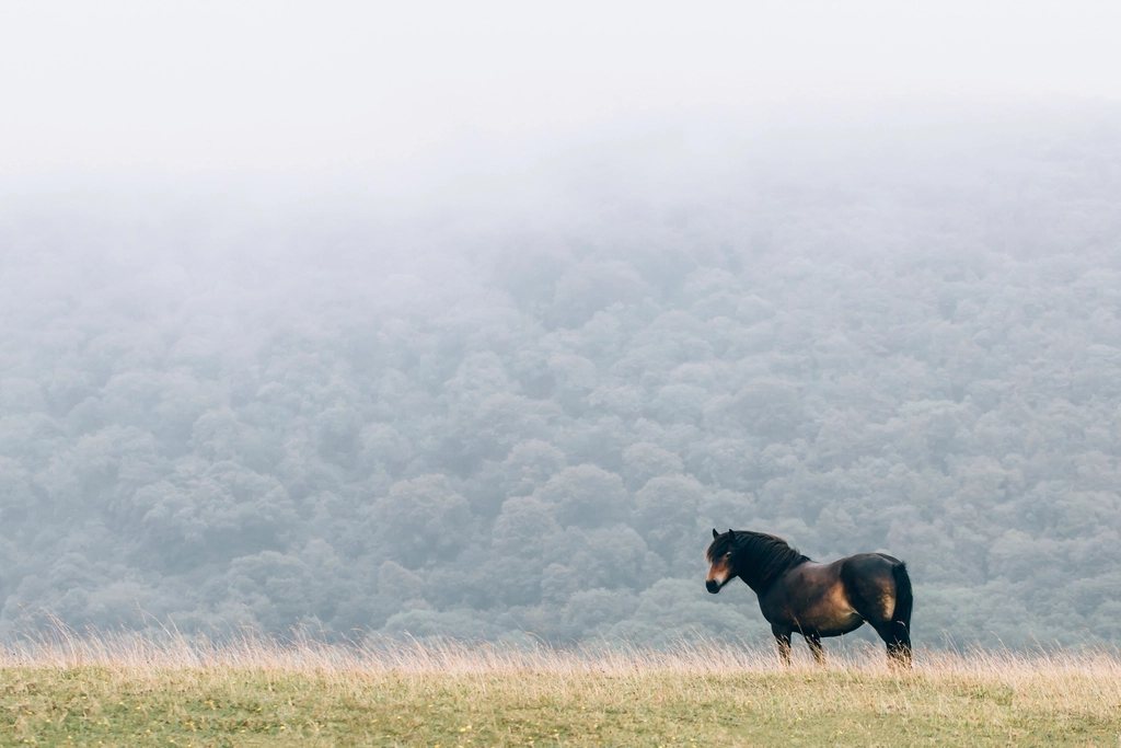
The two moors of the south west are often lumped together and are nothing alike. Dartmoor is granite: a high, bog-topped plateau studded with tors, the largest area of open upland in southern England and the emptiest. Exmoor is sandstone and shale: a rolling upland of deep combes and heather that ends in the highest sea cliffs in the country. Both are national parks, both are walked far less than the northern hills, and both reward a particular kind of planning. This is a guide to what makes each distinctive and how to approach them.
Dartmoor: granite, bog and the northern plateau
Dartmoor National Park, designated in 1951, covers 954 square kilometres, and its highest ground lies in the north. High Willhays, at 621 metres, is the highest point in England south of the Peak District, with Yes Tor at 619 metres beside it. The tors themselves, the weathered granite outcrops that give the moor its character, number well over a hundred, and walking from one to the next across the open moor is the classic Dartmoor day. Between them lies the blanket bog, and it is the bog rather than the height that sets the scale of the walking. Crossing the northern moor from Okehampton to Postbridge, a distance of about 20 kilometres, can take a full day in wet conditions and involves the peat hags around Cranmere Pool, the traditional heart of the moor and the birthplace of letterboxing in 1854.
The south moor is lower and gentler, with a scatter of Bronze Age remains that is among the densest in Europe: stone rows, hut circles, cairns and the enclosed settlement at Grimspound, with its 24 hut circles inside a massive wall. The valleys of the Dart, the Teign and the Tavy cut into the edges, and it is in these that the oak woods survive, most famously the stunted, moss-hung trees of Wistman’s Wood above Two Bridges.
The military ranges and how to plan around them
A large part of the northern moor is used for military training, in three ranges centred on Okehampton, Willsworthy and Merrivale. When live firing is in progress the ranges are closed, marked by red flags on the boundary poles by day and red lamps at night, and walkers must stay out. Firing times are published in advance and are generally clear at weekends in the summer and for extended periods around public holidays. The practical rule is to check the schedule for the day you intend to walk before leaving, and to know the boundaries on the map. Outside firing times the ranges are open, though unexploded ordnance is a real if small risk and anything metallic on the ground should be left alone.
Camping, weather and navigation on Dartmoor
Dartmoor is the one place in England with a lawful right to backpack camp on open moorland, established under local legislation of 1985 and confirmed by the courts in 2025 after a challenge by a landowner. The right applies to designated areas, to small tents carried on foot, and to stays of one or two nights; it is a privilege that depends on people leaving no trace. With it, the northern moor becomes a genuine two-day wilderness crossing, which is unusual in southern Britain.
- Mist is the moor’s chief hazard. The ground is featureless between tors, and the compass matters as much as it does in the Cairngorms.
- Bogs are rarely dangerous but can be exhausting; the worst are marked as mires on the map and are worth a long detour.
- Rivers rise fast after rain and fords that were ankle-deep in the morning can be impassable by afternoon.
- Wild ponies and cattle graze the whole moor; they are not tame and should not be fed.
- Weather comes off the Atlantic and can turn a sunny day into driving rain in an hour; there is no shelter on the high moor at all.
Exmoor: combes, heather and the coast
Exmoor National Park, designated in 1954, covers 693 square kilometres of Somerset and Devon. Its highest point, Dunkery Beacon at 519 metres, is a broad heather ridge with a view to Wales on a clear day, and the moor as a whole is a plateau dissected by steep wooded valleys, the combes, that run north to the sea. The walking is quite different from Dartmoor: paths are clearer, the going is drier, and the days are shaped by the constant climbing in and out of valleys rather than by bog.
The coast is the reason to come. Exmoor meets the Bristol Channel in cliffs that rise to 318 metres at Great Hangman, the highest sea cliff in England, and the South West Coast Path, which begins at Minehead and runs for 1,014 kilometres around the peninsula, has its most strenuous stretch in its first 60 kilometres. The Valley of Rocks near Lynton, a dry valley of tors above the sea, and the wooded gorge of the East Lyn river inland from Lynmouth are the set pieces. Inland, the ancient clapper bridge of Tarr Steps spans the River Barle on seventeen stone slabs, and the Doone valley above Badgworthy Water gives a long, quiet moorland walk with a literary history that every visitor has heard of and few follow to its end.
Wildlife and the night sky
Exmoor holds the largest herd of wild red deer in England, and the autumn rut, from late September to early November, fills the combes with the roaring of stags at dawn. The Exmoor pony is a distinct and ancient breed, and the small free-living herds on the moor are the closest thing Britain has to a native wild horse. Both moors are dark: Exmoor was designated Europe’s first international dark sky reserve in 2011, and a clear moonless night on Dunkery or the northern Dartmoor plateau shows the Milky Way from horizon to horizon. Winter, when the nights are long and the moors are empty, is the time for this.
Linking the two: the Two Moors Way
The Two Moors Way runs for about 164 kilometres from Ivybridge on the southern edge of Dartmoor to Lynmouth on the Exmoor coast, crossing both moors and the farmland of mid Devon between them. It is a walk of six to eight days, wholly without mountains and yet with more variety than most mountain routes, and it ends, fittingly, at the sea. Transport is the planning challenge: the south west has few railways in the moors themselves, and buses to Postbridge, Princetown and the Exmoor villages run mainly in summer. A base at the edge of each moor, with the car left for the week or the bus timetable learned by heart, is the approach that works. The reward is the emptiest upland in the south of England, in weather that is usually kinder than the north, and a landscape that has been walked and worked for four thousand years.