
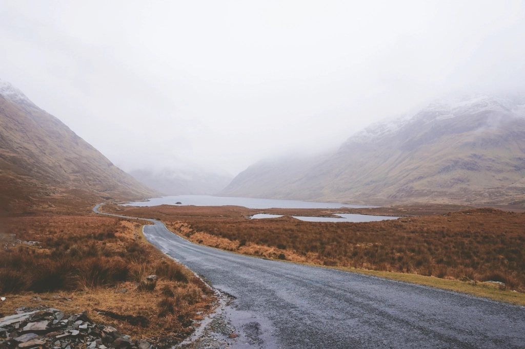
The Wicklow Way begins where a city ends. Its first waymark stands in a public park on the southern edge of Dublin, within reach of a suburban bus, and within an hour the path has climbed out of the houses and onto open hillside with the whole of Dublin Bay behind it. From there it runs south for roughly 130 kilometres, some 80 miles, over the granite uplands of the Wicklow Mountains and down into the softer farmland of south Wicklow and Carlow, finishing in the village of Clonegal. It was the first waymarked long-distance trail in Ireland, and it remains the one by which the others are measured.
How the trail came to be
The idea belonged to J. B. Malone, a Dublin walker and newspaper columnist who spent decades exploring the Wicklow hills and campaigning for a continuous route through them. The first section opened in 1980 and the full trail was complete by 1982. Malone died in 1989, and a memorial stone above Lough Tay marks a viewpoint he particularly loved. The Wicklow Way set the template for the Irish national waymarked trail system: a walking figure in yellow on a black post, a route that stitches together forest roads, old bog tracks and stretches of open mountain, and a deliberate effort to stay clear of tarmac wherever the landowners would allow it.
That last point matters, because Ireland has no general right of access to open country as Scotland does, and far fewer rights of way than England and Wales. The Wicklow Way exists by permission on much of its length, which is why the route sometimes follows a forestry track rather than the ridge above, and why straying from the marked line is discouraged.
The northern hills: Dublin to Glendalough
The first two days are the highest and, for most walkers, the best. From Marlay Park the path climbs Kilmashogue and crosses the shoulder of Two Rock Mountain before descending to Glencullen. It then rises again over Prince William’s Seat to Glencree and Curtlestown, with the cone of the Great Sugar Loaf appearing to the east. Beyond Glencree the route skirts the deep wooded valley below Powerscourt, where one of the highest waterfalls in Ireland drops about 120 metres over a granite lip, then climbs steadily onto the flank of Djouce.
Here comes the section everyone remembers. A boardwalk of old railway sleepers carries the path across the blanket bog of White Hill, at about 630 metres the highest point on the Wicklow Way, and then along the edge of the plateau above Lough Tay. The lake sits in a dark bowl of cliff with a strip of pale sand at its northern end, and on a clear day the view runs south over Lough Dan to the central mountains. The descent to Roundwood and the walk on to Glendalough through Oldbridge and Brusher Gap are gentler, along lanes and forest paths.
Glendalough and Glenmalure
Glendalough, the valley of the two lakes, is the historic heart of the trail. Saint Kevin founded a monastery here in the sixth century, and the round tower, stone churches and carved crosses that survive from its later medieval growth stand among the trees at the mouth of the valley. The Wicklow Way passes straight through the site and then climbs beside the Poulanass waterfall onto the ridge of Mullacor, the last high ground of the route, before dropping steeply into Glenmalure.
Glenmalure is the longest glacial valley in Ireland, a straight trench of a place with the bulk of Lugnaquilla, at 925 metres the highest mountain in Leinster, filling its head. The Wicklow Way does not climb Lugnaquilla, but walkers with a spare day often do, returning to the valley the same evening. The trail itself crosses the river and climbs the far side on forest tracks to reach the pass at Slieve Maan, then descends towards Aghavannagh and the end of the mountains.
The southern half: a different country
South of Aghavannagh the character of the walk changes. The granite gives way to rolling farmland, the forestry thins and the villages grow closer together. The route passes through Tinahely, Shillelagh and Moyne on a mixture of quiet roads, field paths and hill tracks, with occasional climbs over low hills that give views back to the mountains you have left. Some walkers find these days an anticlimax after the high ground; others enjoy the shift from mountain to countryside and the sense of arriving somewhere rather than simply finishing. Clonegal, on the border of Wicklow and Carlow, is a small village on the river Derry, and the trail ends quietly in the village street, with a signpost and not much ceremony.
Direction, timing and days
The trail is almost always walked from north to south, starting from Dublin. The logic is partly practical, since the capital is where most walkers arrive, and partly aesthetic, since it puts the hardest walking first and ends with easy miles. Seven days is the usual allowance, with stages of roughly 15 to 25 kilometres; strong walkers manage it in five, and the northern half alone makes a good long weekend. There are no serious navigational difficulties in good weather, but the high sections around Djouce and Mullacor are exposed, and mist on the plateau can make the waymarks hard to find.
- April to June and September to early October give the best mix of daylight, dry ground and quiet paths.
- Accommodation is sparse between Glendalough and Tinahely; booking ahead is essential in summer, and some hosts collect walkers from the trail.
- Forestry operations occasionally close sections, with signed diversions; check for notices before setting off.
- Camping on the open hill is possible in places but is not a right; ask where you can, and leave no trace.
Why it still matters
There are wilder trails in Ireland and longer ones, but few offer the same arc, from suburb to summit to farmland, in a week of walking. The Wicklow Way was built to prove that a long-distance path could exist in a country without a tradition of them. Forty-odd years later, walked by thousands every year, it has settled into the landscape as if it had always been there.