
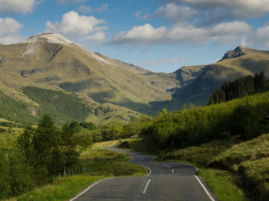
A Munro is a Scottish mountain over 3,000 feet, or 914.4 metres, and there are 282 of them. That single sentence has launched more lifetimes of walking than any other in British hill-going. It has also caused more argument than any other, because the list is not what it appears to be: it is not a set of every summit over the height, it has changed repeatedly since it was first drawn up, and the one man who could have explained the logic behind it died without doing so. What follows is what the list is, how it came to be, and how the people who set out to finish it, the baggers, actually go about the task.
A table, not a rule
In 1891 Sir Hugh Munro, a landowner and founding member of the national mountaineering club, published a table in the club’s journal listing every Scottish summit he believed to exceed 3,000 feet. He counted 283 separate mountains and a further 255 subsidiary tops, and he did it using the survey maps of the day, his own barometer and a great deal of walking. Crucially, he never stated the criterion that made one summit a mountain and its neighbour a mere top. There is no rule about the drop between them. That decision has been made, and remade, by committees of the same club ever since, most recently in 2012 when a resurvey found that Beinn a’ Chlaidheimh in the Fisherfield Forest fell a metre short and the total dropped from 283 to 282. The subsidiary tops now number 227. The list, in other words, is a matter of judgement wearing the clothes of measurement.
Munro himself never completed it. He left two summits for a fitting finish, and one of them, the Inaccessible Pinnacle on Skye, was beyond him. He died in 1919 with his round unfinished. The first person recorded as completing was a minister who finished in 1901, though his claim to one Skye summit has been questioned for a century.
The shape of the list
The Munros are spread from Ben Lomond in the south, an hour from Glasgow, to Ben Hope on the north coast, and from the Cairngorms in the east to the Cuillin of Skye in the west. The highest is Ben Nevis at 1,345 metres; the lowest, Beinn Teallach near Loch Laggan, scrapes in at 915 metres and was only promoted after a resurvey in 1984. The Cairngorm plateau holds the four next highest after the Ben. Skye contributes eleven, all of them rocky and one of them, the Inaccessible Pinnacle, a genuine rock climb graded Moderate that requires a rope, a partner and an abseil to descend. The remotest is generally agreed to be A’ Mhaighdean in the Fisherfield Forest, a full day’s walk from any road.
Most are walks. A large minority involve some scrambling, and a handful of ridges, Aonach Eagach in Glen Coe, the Cuillin ridge, Liathach and An Teallach in the north-west, are serious undertakings in any season. The character of the list is precisely this range: a bagger who finishes has, by definition, learned to walk through bog, to navigate a plateau in cloud, to scramble exposed rock and to climb steep snow.
The rhythm of a round
Registered completions passed the 7,000 mark in the early 2020s, and the club’s list of compleaters, spelt in the old way in honour of the first, grows by a few hundred names a year. The average round takes somewhere around twenty years. The rhythm is set by geography: the southern Highlands give quick single-summit days from the central belt, and most people start there; the Cairngorms and the western glens are visited in weekend clusters; the far north-west and the Skye Cuillin are saved until the bagger is competent and committed, and are the reason many rounds stall for years at around 250. A bagger who finishes the Fisherfield six, the Knoydart three and the Cuillin eleven has done the hard part.
Some conventions have grown up around the list without ever being written down:
- The last summit is chosen for its view or its sociability, and friends are invited; Ben More on Mull and Ben Lomond are popular last hills.
- The round is registered by writing to the club, which asks only for a date and a final hill and takes the applicant’s word for the rest.
- Repeated rounds are counted; several people have completed ten or more, and a continuous self-propelled round of all 282, on foot, bike and by swimming to the islands, has been done in under forty days.
- Winter rounds, with every summit climbed between December and March, exist but are measured in single figures.
Access, seasons and the deer
Scotland has a general right of responsible access to open land, confirmed in law in 2003, which means Munro baggers do not need permission to walk anywhere on the hills. The practical exception is the stalking season. Red deer stags are culled between July and October, with the busiest period in September and early October, and hinds through the winter until mid-February. Walkers are not banned, but on many estates a request is posted asking that certain glens be avoided on certain days, and a phone service and website exist through which estates publish their plans. Checking is a courtesy, not a legal requirement, and it is the courtesy that keeps the access right uncontroversial.
The other season to plan around is the Scottish winter, which on the high tops runs from November to April and can arrive in October. A Munro under snow is a different mountain: the paths vanish, the cornices grow, and the walk-in on frozen bog becomes the easy part. A great many baggers stop for the winter; a growing number take an axe and learn the plateau navigation that the season requires.
Beyond the Munros
The list has spawned others, each with its own society and register. The Corbetts are the 222 Scottish hills between 2,500 and 3,000 feet with a drop of at least 500 feet on all sides, a stricter definition than the Munros ever had and, many would say, a finer collection of mountains. The Grahams take the band from 2,000 to 2,500 feet, and the Donalds cover the Southern Uplands. Munroists who finish and then go on to the Corbetts tend to report that the smaller hills have better views, emptier summits and far worse paths. The rules of bagging, in the end, are the rules of any good habit: it should get you out of the door on a grey Saturday, it should take you somewhere you would never have gone alone, and it should not be allowed to make a poor decision on a ridge in a gale. The summit will still be there.
Read next: Pendle Hill, Lancashire: Planning a Walk on Witch Country's Summit