
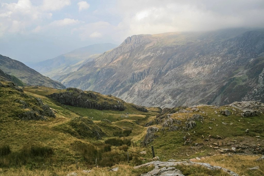
Yr Wyddfa, still better known to most visitors as Snowdon, is the highest mountain in Wales at 1,085 metres and the busiest mountain in Britain. Six recognised paths reach the summit, and on a fine summer Saturday all six are in use at once. Three of them start from the eastern side and are the ones most people mean when they talk about climbing Snowdon: the Pyg Track and the Miners’ Track from Pen-y-Pass, which share a finish, and, from the opposite side of the mountain, the quieter Rhyd Ddu Path. We have walked all three in every combination, and the differences between them are larger than the summary tables suggest.
Pen-y-Pass: the starting point that decides your day
Both the Pyg and the Miners’ Track begin at Pen-y-Pass, the top of the Llanberis Pass at 359 metres. That altitude is the whole attraction: it removes a third of the climb before you have taken a step. It is also the reason the car park there is oversubscribed. Parking spaces must be reserved well in advance through the national park’s booking system, and on most days the practical choice is to leave the car lower down the valley, or in Llanberis, and take the shuttle bus service that runs to the pass. Plan the day around the bus times rather than hoping for a space; arriving at seven in the morning without a reservation no longer works.
From the pass, both tracks head west. They separate within a hundred metres and do not meet again until they are 250 metres below the summit.
The Pyg Track: high, rocky and direct
The Pyg Track is the shorter and more mountainous of the pair. It leaves Pen-y-Pass through a gap in the wall and climbs steadily on a pitched rock path to Bwlch y Moch, the pass of the pigs, at about 570 metres, where the Snowdon Horseshoe opens out ahead: Crib Goch on the right, the summit straight on, Lliwedd on the left, and the two lakes of Llyn Llydaw and Glaslyn far below. This is the point where the scramblers’ route to Crib Goch peels off up to the right; it is a grade one scramble along a knife-edge and not a path for walkers, whatever the map might suggest.
The Pyg continues as a rising traverse above Glaslyn, rocky underfoot but never difficult, until it meets the Miners’ Track coming up from the lake at a large standing stone. From there the two routes are one: the zig-zags, a well-built series of hairpins gaining about 300 metres to Bwlch Glas on the summit ridge, where a tall finger stone marks the top. The final 150 metres of ascent follow the railway line to the summit. The Pyg is roughly 5.6 kilometres each way with about 720 metres of ascent; four to six hours for the round trip is typical. Its name is uncertain. It may derive from Bwlch y Moch, or from the nearby Pen-y-Gwryd, or from the pig-shaped rock said to lie beside it; nobody has settled the question.
The Miners’ Track: three lakes and a sting in the tail
The Miners’ Track is the gentler start and the harder finish. It was built to serve the copper mines above Glaslyn, which explains its early character: a broad, almost level stone road that follows the contour past Llyn Teyrn, then crosses Llyn Llydaw on a causeway with the summit crags reflected in the water. The ruined crushing mill and workers’ barracks by the lake were in use until the mine closed in 1916. The track then climbs more purposefully to Glaslyn, a deep, steep-sided lake at 600 metres whose colour, on the right day, is a startling blue-green from the copper in the rock.
What follows is the section that catches people out. From the shore of Glaslyn, the path climbs steeply for about 200 metres up a rough, rocky slope to join the Pyg at the standing stone. Walkers who have been lulled by the first hour of easy going find themselves scrambling up loose stone with the summit still an hour away. The Miners’ Track is about 6.4 kilometres each way with the same total ascent as the Pyg, but the ascent is compressed into the second half. The classic combination, and our recommendation, is to climb by the Pyg and descend by the Miners’ Track, so that the steep ground is taken on the way up and the lakeside walk is saved for tired legs in the evening.
Rhyd Ddu: the ridge walk from the west
The Rhyd Ddu Path starts from the village of the same name on the western side of the mountain, at around 190 metres. It is the least busy of the three by a wide margin, partly because it starts lower and partly because it is not in the same valley as everything else. The route follows an old quarry track before turning up the broad grassy slopes onto the Llechog ridge, which it then follows in a great curve above the cliffs of Cwm Clogwyn. The last kilometre along Bwlch Main is the finest walking on the mountain: a narrow, rocky crest with steep drops on both sides, never a scramble, but exposed enough to feel like a mountain ridge rather than a path. It joins the Watkin Path just below the summit.
The Rhyd Ddu Path is around 6 kilometres each way with about 890 metres of ascent; allow five to seven hours for the round trip. In poor visibility the Bwlch Main section demands attention, and in strong wind it is best avoided. Its great advantage, beyond the quiet, is the view west over the Nantlle ridge and out to the sea.
The summit, and the winter version
The summit cairn stands a few metres above a visitor building that opens roughly from Easter to the end of October, in step with the rack railway from Llanberis. Outside that season the building is shut and the top is a bare, windy ridge with no shelter. From November onwards the zig-zags fill with old snow that becomes hard ice, and the slope above Glaslyn has produced serious falls almost every winter; in those months the Pyg and Miners’ Track above the standing stone should be treated as a winter climb requiring an axe and crampons, and the Llanberis Path from the north becomes the sensible choice. On a summer day, though, with the bus booked and an early start, the Pyg up and the Miners’ down remains the finest introduction to Welsh mountains there is.