
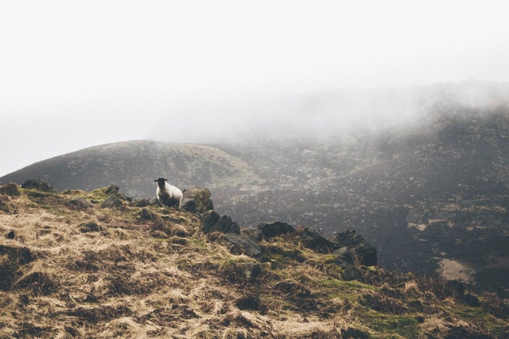
The Pennine Way was the first, and for many walkers it remains the one that counts. Opened on 24 April 1965 after thirty years of campaigning, it runs 268 miles from Edale in the Peak District to Kirk Yetholm, just over the Scottish border, along the high spine of northern England. It was proposed in 1935 by the journalist and rambler Tom Stephenson, at a time when most of these moors were closed to the public and gamekeepers still turned walkers back. The trail’s very existence is bound up with the fight for access to open country, and something of that hard-won, slightly stubborn character has never left it.
What the numbers mean
Two hundred and sixty-eight miles is the official figure; with detours to accommodation most people walk closer to 280. The route passes through three national parks, the Peak District, the Yorkshire Dales and Northumberland, and crosses the North Pennines between them. Total ascent is in the region of 11,000 metres. The highest point is Cross Fell at 893 metres, the summit of the Pennines and the highest ground in England outside the Lake District. A fit walker completes it in sixteen to nineteen days. Fewer than that means very long days over rough ground; more means a pleasant three weeks with time to look around.
The conventional direction is south to north, which keeps the prevailing south-westerly wind behind you and saves the Cheviots, the wildest stretch, for last. It also means beginning at Edale, where the first climb is straight up onto Kinder Scout, the plateau where the 1932 mass trespass took place. The symbolism is hard to miss.
The Dark Peak: bog, flagstones and gritstone
The southern third of the Pennine Way has a reputation it no longer entirely deserves. For decades Kinder Scout, Bleaklow and Black Hill were a byword for knee-deep peat, and early walkers spoke of the first three days as a test of character. Since the 1990s the worst of the eroded ground has been paved with reclaimed flagstones from demolished mills, laid end to end across the bog. The result is dry feet and a surface that lets you look up at the moor instead of down at your boots. Purists grumble; the peat, which is recovering, does not.
Beyond Standedge and the M62 crossing, the path settles into the gritstone country of the South Pennines. Stoodley Pike, a tall monument built to mark the end of the Napoleonic Wars, stands above the Calder valley; the moors near Haworth are Bronte country, and the ruined farmhouse at Top Withens is where the trail meets a small crowd of literary pilgrims before returning to solitude.
Limestone country and the Three Peaks
At Gargrave the landscape switches from dark millstone grit to pale limestone, and the walking becomes some of the best in the country. Malham Cove, a curving wall of rock eighty metres high, is climbed by steps at its western end onto a pavement of clints and grikes. Beyond lie Malham Tarn, the dry valley of Fountains Fell and then Pen-y-ghent, at 694 metres one of the Yorkshire Three Peaks, with a short scramble up its southern nose. The descent to Horton in Ribblesdale passes the potholes of Hull Pot and Hunt Pot, where streams simply vanish into the ground.
From Horton the trail follows old drove roads and packhorse tracks to Hawes, then climbs Great Shunner Fell at 716 metres before dropping into Swaledale at Thwaite and Keld. Here it crosses the Coast to Coast, and for a day or two walkers on the two routes share the same stone barns and the same weather.
The North Pennines: the loneliest section
North of the Dales the Pennine Way enters the North Pennines, a high, empty plateau that many walkers rate as the finest part of the whole route. The path follows the Tees upstream past Low Force and High Force, where the river drops 21 metres over a step of dolerite, then past the cascades of Cauldron Snout to reach High Cup Nick. This is one of the great sights of England: a U-shaped valley cut with geometric precision into the Whin Sill, its rim lined with columns of dark rock, and the Eden valley and Lakeland fells laid out beyond.
From Dufton the trail climbs over Great Dun Fell, with its radar station, to Cross Fell. The summit plateau is exposed to the Helm Wind, the only named wind in Britain, and can be under cloud or snow when the valleys are fine. A stone bothy on the northern flank, maintained by volunteers, is a well-known refuge. The long descent to Garrigill and Alston follows an old mining track across bleak fell.
Hadrian’s Wall and the Cheviots
After Alston the route wanders through low farmland and forest to the Roman frontier, where it turns east and shares roughly eight miles with the Hadrian’s Wall Path along the crags of the Whin Sill. Then it strikes north through the plantations of Wark Forest and Kielder to Bellingham and Byrness, the last village before the border.
The final stage, from Byrness to Kirk Yetholm, is 27 miles along the crest of the Cheviot Hills with no habitation, no road and no shelter except two small wooden refuge huts placed along the ridge. Some walkers do it in one very long day; others carry a tent or sleep in a hut and split it in two. The Cheviot itself, at 815 metres, is an optional there-and-back detour from the main ridge. On a clear day the whole of the Borders lies ahead and the Pennines, at last, lie behind.
Practicalities
The Pennine Way is a serious undertaking and is best treated as one. The following points cover most of what goes wrong:
- Weather is the deciding factor. May, June and September offer the best odds; winter walking requires full mountain equipment and short days make the long stages impractical.
- Navigation is straightforward on the flagged sections but demanding on Cross Fell, in the Cheviots and on any moor in cloud. A map and compass are not optional.
- Accommodation is thin in the North Pennines and Cheviots. Book well ahead in summer and be prepared to camp or use the refuge huts.
- Resupply is possible every two or three days, but not every village has a shop.
Many people walk the Pennine Way once and never repeat it. Few regret it. It is not a route for admiring scenery from a bench; it is a route for crossing a whole region on foot, in the weather that region provides, and arriving at the other end knowing the north of England in a way no road journey can offer.