
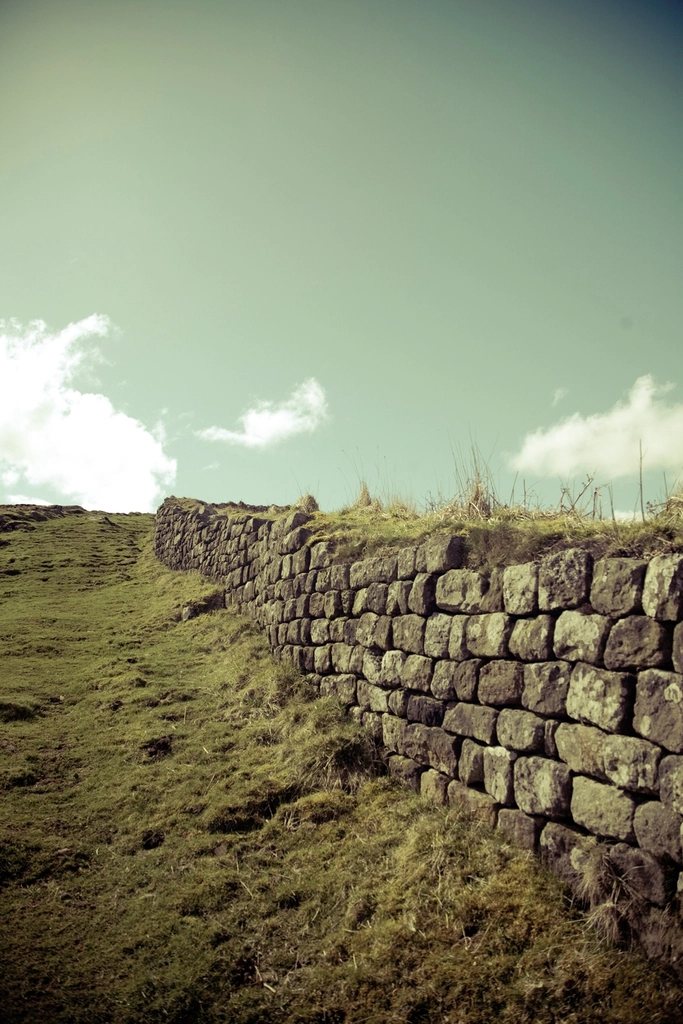
For most of its 84 miles, Hadrian’s Wall Path does something no other National Trail can do: it follows a single structure, built to a single plan, by a single empire, from one sea to another. The wall was begun in AD 122 on the orders of the Emperor Hadrian and ran for 80 Roman miles, about 73 modern miles, from the Tyne to the Solway. The trail, opened in 2003, extends that line at both ends, starting among the shipyards of Wallsend on Tyneside and finishing in the salt marsh village of Bowness-on-Solway. It is a week’s walk through two thousand years of history, and one of the gentler long-distance routes in Britain.
What you are walking beside
It helps to know the vocabulary. The wall itself was a stone curtain up to about 4.5 metres high, with a ditch on the northern side. Every Roman mile stood a milecastle, a small fortified gateway, and between each pair of milecastles were two turrets. Behind the wall ran the Vallum, a broad flat-bottomed ditch flanked by earth mounds, marking the military zone. Sixteen larger forts were built on or near the line to house the garrison. What survives today ranges from nothing at all under the streets of Newcastle to long stretches of standing masonry in the central section, which is why the wall was inscribed as a World Heritage Site in 1987.
The path keeps the wall or its line in view for nearly the whole route, but it is not the same as walking on the wall. Climbing on the masonry is prohibited, and in the central section walkers are asked to keep to the marked path rather than the grassy top of the earthworks, which erode quickly when wet. The trail managers ask people to avoid the higher ground in the wettest winter months for the same reason. This is one of the few long walks in Britain where the surface you are treading on is itself a scheduled monument.
East to west, or west to east?
Either direction works. Starting at Wallsend and walking west has the advantage of building slowly: the first day is an urban riverside walk along the Tyne, the second crosses farmland, and the drama of the crags arrives in the middle of the week when your legs are ready for it. Walking east from Bowness puts the prevailing wind behind you and saves Newcastle for the end. The classic itinerary takes six days, with the central two days between Chollerford and Gilsland being the ones that matter. Fit walkers manage it in five; those who want time in the forts and museums along the way should allow seven.
The central section: crags and the Whin Sill
Between the North Tyne and the Irthing the wall does what its builders intended, taking the high ground along the Whin Sill, an intrusion of hard dolerite that forms a line of north-facing crags across Northumberland. This is the section everyone photographs. From Sewingshields the path rides the crest of the crags past Housesteads, the best-preserved fort on the line, through the dramatic dip of Sycamore Gap, where the famous tree stood until it was felled in 2023, and over Winshields Crags, the highest point on the trail at 345 metres.
The walking here is a series of short, sharp climbs and descents as the crags rise and fall. Crag Lough sits below the cliffs, and on a clear day the view north stretches over Wark Forest to the Cheviots. At Cawfields and Walltown the line is interrupted by old quarries, which removed sections of wall before anyone thought to stop them, and the path threads around the flooded pits. Beyond Walltown the crags subside, the wall drops towards Gilsland, and the character of the walk changes again.
The quieter ends
The eastern approach through Newcastle is often underrated. The path follows the Tyne from the excavated fort at Wallsend, under the bridges of the city centre and out through parkland to Heddon-on-the-Wall, where the first stretch of standing masonry appears. From there to Chollerford the route follows the line of the wall closely, often beside the road that was built on top of it in the eighteenth century, with the Vallum ditch a constant companion in the fields.
West of the Irthing the wall was originally built in turf and later rebuilt in stone, and much less is visible above ground. The path descends through the farmland of the Cumbrian plain to Carlisle, then follows the river Eden to the Solway. The last miles are flat and open, along the edge of a tidal estuary where the road can flood at high spring tides and signs warn drivers and walkers alike. Bowness-on-Solway is a small, quiet place, and the shelter that marks the end of the trail looks out over the water to Scotland.
Forts, museums and the wider frontier
The wall was only one part of a frontier system that included outpost forts to the north, supply bases to the south and a chain of towers along the Cumbrian coast. Several of the excavated forts sit directly on the route or a short detour from it: Segedunum at Wallsend, Chesters beside the North Tyne, Housesteads on the crags, Birdoswald above the Irthing gorge. Vindolanda, a mile south of the wall, is famous for its writing tablets and its ongoing excavations. Entry fees apply at most of these sites, and combined tickets or membership schemes can reduce the cost for a week-long walk. A stamping passport for the trail is also available, collected at points along the way.
Practical notes
The Hadrian’s Wall Path is often described as a good first long-distance walk, and the description is fair. It is well waymarked, mostly on good paths, and never far from a village or a bus route. A few points still deserve attention:
- The central section is exposed and the crags are slippery when wet; a proper waterproof and boots with grip make the difference.
- Accommodation in the middle of the route is limited and booked out early in summer; the shoulder seasons of May and September are the easiest time to find beds.
- Shops are scarce between Chollerford and Gilsland; carry lunch for the crag days.
- Late autumn and winter walking is possible, but the trail managers ask for care on the earthworks when the ground is saturated.
Few walks combine so much history with so little difficulty. A week on the wall leaves most people with a clear sense of the frontier as a place rather than a line on a map, and with the mild surprise of having crossed England, coast to coast, without ever really noticing the effort.