
There is a small ritual at the start of the Coast to Coast. You walk down to the shingle at St Bees, dip the toe of a boot in the Irish Sea, and pick up a pebble. Roughly 190 miles later, if all goes to plan, you throw that pebble into the North Sea at Robin Hood’s Bay. Between the two lies the most varied fortnight of walking in England: the high fells of the Lake District, the limestone and lead-mining country of the Yorkshire Dales, the flat Vale of Mowbray, and the heather plateau of the North York Moors. Three national parks, one line drawn west to east across the map.
A route by one man, now a trail for everyone
The Coast to Coast was never an official trail to begin with. It was devised by Alfred Wainwright and published in 1973 as a personal suggestion: a way of linking existing rights of way, old packhorse routes and open fell into one continuous journey. For nearly fifty years it survived on word of mouth, on his hand-drawn pages, and on the goodwill of landowners along the way. In 2022 it was announced that the route would be designated a National Trail, with the waymarking, path repairs and legal certainty that status brings. The upgrade work has been rolling out since then, so expect some sections to be better signed than others.
The exact distance is a matter of debate, because the original route offered alternatives in several places. Most modern measurements come out somewhere between 182 and 192 miles, and 190 is the figure everyone quotes. Walking it in the traditional west-to-east direction keeps the prevailing wind, and the rain it carries, at your back.
The Lake District: the hardest days come first
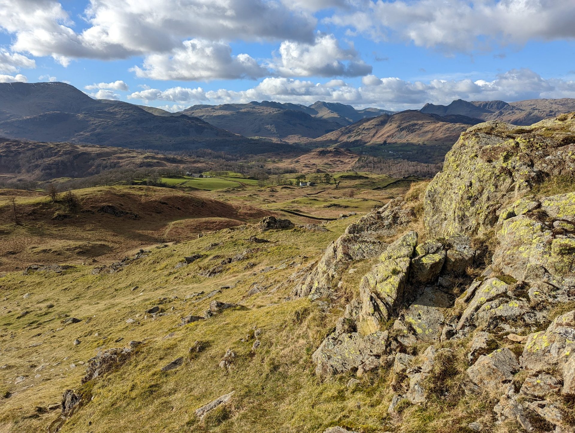
The Cumbrian coast gives way almost immediately to the fells. From St Bees the path skirts the cliffs, turns inland through farmland and reaches Ennerdale Bridge on the first evening. The following day is a long one along the shore of Ennerdale Water, up the valley past the forestry and over Loft Beck to Honister, then down into Borrowdale. It is here that the Coast to Coast earns its reputation. The Lakeland stages between Ennerdale and Shap include the highest ground on the route: the high-level option over Kidsty Pike reaches 780 metres, with Haweswater laid out below.
The classic itinerary breaks the mountains into four or five days, passing through Rosthwaite, Grasmere and Patterdale before the long descent to Shap. Each of these valleys has its own choices. From Rosthwaite you can go over Greenup Edge and down Far Easedale, or take the ridge over Helm Crag. From Grasmere the straightforward line follows Grisedale up and over to Patterdale; the ambitious add Helvellyn and Striding Edge, which is only sensible in settled weather. Navigation matters. Cloud sits on these tops for days at a time, and the paths, although well used, are not always obvious on the ground.
Limestone, lead and Swaledale
After Shap the character changes completely. The route crosses the M6 and enters the limestone plateau around Orton and Kirkby Stephen, where the walking is fast and the views open out over the Howgills and the northern Dales.
From Kirkby Stephen the path climbs to Nine Standards Rigg at 662 metres, the watershed of England, marked by a line of tall stone cairns of uncertain age. The peat on the far side is fragile. A seasonal rotation of three descent routes has been in place for years to spread the erosion, with different lines used in different months, and the signage asks you to follow whichever is current. Below lies Swaledale, one of the finest valleys in the country. Keld, Muker and Reeth sit among stone barns and hay meadows, and the higher variant along the north side of the dale passes the spectacular ruins of the Swaledale lead-mining industry: crushing floors, smelt mills and the scars of hushes where water was released to strip the hillside.
The flat middle and the Vale of Mowbray
Richmond, with its Norman castle above the Swale, is the largest town on the route and the natural place for a rest day. Beyond it comes the section that few people look forward to and everyone remembers with a certain affection: the Vale of Mowbray. Some 23 miles of farmland separate Richmond from Ingleby Cross, and the ground barely rises above 60 metres the whole way. Many walkers do it in one long day to reach the moors quickly. Others treat it as a recovery stage. Either way it is a reminder that a coast-to-coast line has to take the lowlands as they come.
The North York Moors and the last of the heather
The final act begins at the escarpment of the Cleveland Hills. From Ingleby Cross the path climbs onto the Cleveland Way, which it shares for a dozen miles, and switchbacks over a series of steep-sided tops: Carlton Bank, Cringle Moor, Hasty Bank and the Wainstones. Then the moors proper open up. The old railway trackbed from Bloworth Crossing carries you effortlessly around the head of Farndale to Blakey Ridge, and in late August the whole plateau is purple with heather. This is the largest expanse of heather moorland in England, managed for grouse and grazing, and the walking is easy but exposed.
The descent to Glaisdale and Grosmont brings you into the Esk valley, where a heritage steam railway runs beside the path. From Grosmont the last climb crosses Sleights Moor before a long finish along the cliffs from Hawsker into Robin Hood’s Bay. The village tips steeply down to a slipway, and the tradition is to keep walking until your boots are in the sea.
Planning the walk
Most people take between twelve and fifteen days. Two weeks is the sensible average, with the Lake District stages kept short and the eastern stages allowed to run long. Accommodation is limited in the smaller villages and fills quickly between May and September, so it is normal to book the whole line in advance. Baggage transfer services operate along the route if you prefer to walk with a day pack. A few practical points are worth carrying in your head:
- The Lake District days are the most serious: carry a map and compass, know how to use them, and have a bad-weather alternative for each pass.
- Wild camping is tolerated on the high fells if done discreetly, but not in the farmed valleys of the Dales or the Vale of Mowbray.
- Shops and cash machines are scarce east of Richmond until Grosmont; plan food for two or three days at a time.
- Late spring and early autumn give the best combination of long days, dry paths and quiet accommodation.
The Coast to Coast is neither the longest trail in Britain nor the wildest. Its appeal is the way it strings together three quite different landscapes and delivers you, sunburnt or soaked, to the edge of a different sea. The pebble in your pocket is a small thing, but by the time you reach the slipway it has come a long way.