
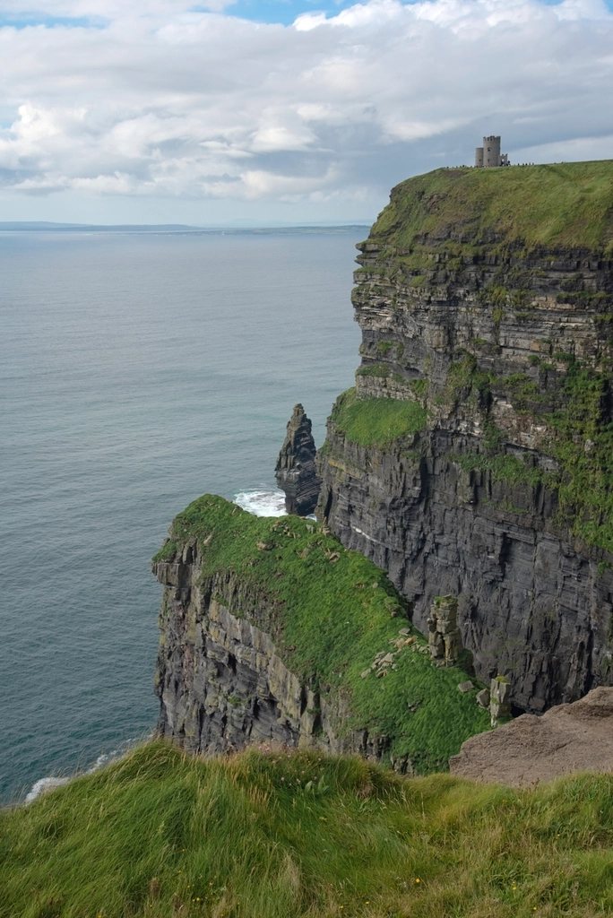
Kerry has two of the finest long-distance walks in Ireland, and they sit side by side on the map like a pair of question marks. The Kerry Way loops for around 214 kilometres, about 133 miles, around the Iveragh peninsula from Killarney and back. The Dingle Way makes a shorter circuit of roughly 179 kilometres, or 111 miles, around the Dingle peninsula from Tralee. Both are waymarked with the same yellow walking figure, both follow old roads and green tracks rather than mountain ridges, and both deliver, in a week or so each, the essential south-west of Ireland: Atlantic weather, red sandstone hills, small fields running down to the sea, and a way of life that still leans on the Irish language on the far western tips.
Two peninsulas, two characters
The Iveragh peninsula is the larger and the higher. It holds the MacGillycuddy’s Reeks, with Carrauntoohil at 1,038 metres the highest mountain in Ireland, and the Kerry Way walks around and beneath them rather than over them. The Dingle peninsula is narrower and more exposed, a long finger of land pointing at the Blasket Islands, with Mount Brandon at 952 metres rising near its end. The Dingle Way crosses the mountain’s shoulder; the Kerry Way never climbs much above 400 metres. Put simply, the Kerry Way is a walk of valleys, passes and lake shores, while the Dingle Way is a walk of beaches, cliffs and one big hill.
The Kerry Way: from Killarney around Iveragh
The Kerry Way is the longest of Ireland’s waymarked trails and is usually walked anticlockwise over nine days. It leaves Killarney through the woods and lakes of the national park, passes the Torc waterfall and the shore of the Upper Lake, and enters the Black Valley beneath the southern wall of the Reeks. This first stretch is the wildest, following an old road over the pass to Glencar with the mountains close on both sides and very little habitation. The second and third days continue through Glencar and over the Windy Gap to Glenbeigh, where the route reaches the coast and the views open across Dingle Bay to the peninsula to the north.
From Glenbeigh the Way follows the southern shore of the bay on high ground above the road, then rounds the western end of the peninsula through Cahersiveen and Waterville. These are the days that justify the whole undertaking: green tracks along the hillside, the Skellig islands standing off the coast like broken teeth, and old mass paths, used for generations to reach church across the hills, threading between the fields. Beyond Waterville the path climbs over the pass above Caherdaniel and descends to the wooded coast around Derrynane before turning east along the Kenmare River, which is not a river but a long sea inlet, through Sneem to Kenmare.
The final stage from Kenmare back to Killarney crosses a second Windy Gap and drops back into the national park, closing the circle among the oaks and hollies of Killarney’s lakeshore. Most of the route follows drove roads, butter roads that once carried produce to market, and tracks between farms; there is little open bog and no scrambling, but the stages are long, several exceed 25 kilometres, and the weather on the Atlantic side can turn a pleasant track into a river in an hour.
The Dingle Way: from Tralee around Corca Dhuibhne
The Dingle Way begins in Tralee and, like its neighbour, is normally walked anticlockwise, which puts Mount Brandon near the end. The first day heads west along the canal to the windmill at Blennerville and then onto the northern flank of the Slieve Mish mountains, contouring above Tralee Bay to Camp. From there the route crosses the peninsula to its southern side and follows the coast through Annascaul to Dingle, passing above the long strand at Inch, a sand spit that runs several kilometres out into the bay.
West of Dingle the trail enters the Gaeltacht, the Irish-speaking district, and the landscape becomes the one that appears on every postcard: the road and path along Slea Head, the cliffs above Coumeenoole, and the Blasket Islands lying offshore, abandoned in 1953 when the last inhabitants were moved to the mainland. The path continues round the tip of the peninsula past the beehive huts and the dry-stone oratory at Gallarus, a small early Christian church that has stood without mortar for perhaps a thousand years, and reaches the north coast at Feohanagh.
Then comes the mountain. From the north side the Way climbs to the pass between Mount Brandon and Masatiompan at around 650 metres, the highest point on the trail, before dropping steeply to Brandon village and Cloghane. In clear weather this is the finest day of either walk, with the Three Sisters headlands behind and the great sweep of Brandon Bay ahead. In cloud it is a serious crossing, exposed and with few landmarks, and walkers without a compass have been known to wait a day for it to clear. The last two stages are almost entirely on sand, along the beaches of Brandon Bay and the Maharees to Castlegregory, then back along the shore and the canal to Tralee.
Which one to walk first
Walkers who want mountains and remoteness usually prefer the Kerry Way. Walkers who want the sea, archaeology and shorter days usually prefer the Dingle Way. Both are well marked and both can be broken into sections with a bus at either end, though services on the peninsulas are infrequent and need checking in advance. Neither requires special permits, and both pass through farmland by agreement with landowners, so dogs, gates and fences deserve the usual courtesy.
- May, June and September are the most reliable months; July and August bring more visitors to Dingle and Killarney and fewer free beds.
- Each trail has stages over 25 kilometres; shortening them means adding a night in a village off the route.
- Rain is not a risk but a certainty; full waterproofs, spare socks and a dry bag for the map are part of the kit.
- The Brandon crossing on the Dingle Way should be planned for a clear day, with an alternative low-level road route in reserve.
Two weeks in Kerry
The ambitious can join the two. Finish the Kerry Way in Killarney, take a bus to Tralee, and set off again the next morning. Two weeks and nearly 400 kilometres later you will have walked around both peninsulas, crossed one mountain pass in each, and seen the south-west of Ireland from the only angle that really counts, which is slowly, on foot, and usually in the rain.